Top Digital Land Survey Company in Bangladesh
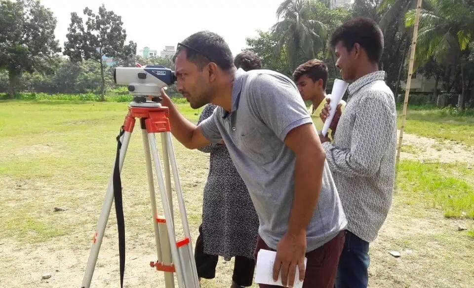
Before starting any development works, a Survey is required from the Best Digital Land Survey Company in Bangladesh. It helps to obtain the correct land management. A manual hand survey cannot turn out the correct land measurement. Tapes and chains have innumerable limitations and errors. In this case, the digital survey may mitigate these issues. It’s the EDM which stands for Electronic Distance measuring. We’ve got EDM devices like Total Station, Level, surveyor’s instrument, etc. to handle any MEGA projects in Bangladesh. We have successfully conducted 250+ works in Bangladesh. We always try to maintain the highest level of accuracy and precision in every engagement. Our experienced Surveyor will assist you in obtaining the actual measurement of your project area.
Best Digital Land Survey Company in Bangladesh
Planning to start your future project? We are ready to serve you. We have completed many mega projects in Bangladesh. Topographic survey of 10 Power Station Projects for China Energy Engineering Group (CEEG). Jahanabad Cantonment, Khulna of about 246 Acres of land. Pallathol Tea Resort at Moulovibazar of 870 Acres of Land. ADB Financed the Muhuri Irrigation Projects of 240km Irrigation Canal. IPCO Complex Airport Village of 2,50,000 SFT Cladding Survey etc. Currently, we are working with PWD, RHD, WDB, PDB, and LGED Projects.
WE ARE EXPERTS IN:
SI
Description of Works
SI
Description of Works
01
Topographic Survey
12
Contour Survey
02
Layout/Setting out Survey
13
Map Pantographic
03
Railway Survey
14
Cladding Survey
04
River and Irrigation Canal Survey(Pre & Post Work)
15
Township Survey
05
Transmission Line Survey
16
Road and Highway Survey
06
Drawing Digitization
17
Dam Survey(Pre & Post Work)
07
DGPS Survey
18
Hill Survey
08
Pipeline/Gas Line Survey
19
Earth Cutting & Filling Calculation
09
Airport Base Survey
20
RTK GPS Survey
10
Airport Base Bridge Survey
12
Facade Survey
11
As Build Survey of Existing Structure
Best Digital Land Survey in Bangladesh
OUR EQUIPMENT:
SI
Description of Item
Quantity
01
Level Machine
3 Set
02
RTK GPS
1 Set
03
Level Machine
20 Nos
04
DHLR Camera
1 Nos
05
Vehicle
2 Nos
06
HP Plotter
1 Nos
07
GPS
5 Set
08
Hydrographic Instrument
1 Set
09
Mini Prismatic
5 Nos
10
Walkie-Talkie
10 Nos
11
Laptop
10 Nos
12
Scanner
3 Nos
13
DGPS
1 Set
14
A3 Printer
2 Nos
15
Accuracy Stand
5 Nos
16
Security Dress
30 Net
17
Notebook
2 Nos
18
Photocopier
3 Nos
OUR HISTORY IN NUMBERS:
Why SHELLMARK is the Best Digital Land Survey Company in Bangladesh?
1. 10+ Years Experience in Survey Works
SHELLMARK has been working in the Land survey sector for more than 13 Years. We have conducted a large number of projects in different Government and Private Organizations. We have successfully delivered about 250+ projects since our inception. SHELLMARK is the most popular company in the List of Digital Land Survey Companies in Bangladesh. We have a lot of experience in Topographic Surveys, Contour Surveys, Layout Survey, and Layout Surveys. We are also experienced in Irrigation Canal Survey. SHELLMARK has completed about 240 km Long and cross-sectional survey for Muhuri Irrigation Projects in 2018. Muhuri Irrigation Project is the Largest Irrigation project in South Asia.
2. We Have 64 Districts of Service Coverage
Whether it is a Small or Large Digital survey works. Our team is ready to move any Districts within the possible shortest time. We are capable of mobilizing our team and equipment to any district within 24 hours before confirmation. Our swift and committed service ranks us in the Top 10 Digital Land Survey Company in Dhaka, Bangladesh. We have our own logistics facilities to move any project location. Most importantly, we carry our equipment along with our laptop so that we can be able to prepare the data processing at the working district. But we take at least 2 days to move to hilly areas i.e. Chittagong, Khagrachari, and Bandarban. We also do the same for coastal areas i.e. Sandip, Saintmartin, and Kuakata.
3. Experienced Digital Survey Team
Most of our survey Experts are Diploma holders from Reputed Survey Institutes. Our Lead Surveyors have more than 20 years of experience. Senior Surveyors have more than 15 years of experience. Every Survey assistant has more than 5 years of experience in the relevant field. We do not recruit any trainee surveyors in our company. We also follow a specific recruitment policy to pick up the best surveyor. A newly appointed surveyor is kept on 6-month probation period to observe his work. During this period, he works as a Survey Assistant with the senior surveyor. We also try to retain our surveyor for long years to our company. You must not have any confusion about the capacity of our surveyors anymore.
4. Maintain Highest Field Accuracy
Fieldwork accuracy is the most important issue in Digital Survey Works. we always try to maintain 3mm accuracy in small projects and 5mm accuracy in Large projects. Which is possible for maximum accuracy in Digital Survey Works. We always cover more possible points on the field to ensure the highest field accuracy. It is difficult to maintain the highest accuracy in level flying works. We have a proven level fly accuracy of 2 inches in a 150 Km survey of the Muhuri Project Canal Survey work. We always ask our clients to be present at the site during survey work. Which ensures the highest accuracy and mitigates field confusion. If any confusion arises during data processing, we generally move to the site again to make sure. It is your kind information that you, be sure about your boundary dispute before hiring a Digital Land Survey Company in Dhaka, Bangladesh.
5. Secured Data Privacy and Accuracy
Data privacy is a burning issue in Land Survey Works. The field data may be edited or manipulated by any unfair means. We are very strict in this process. We do not share or manipulate our field data in any instances. The machine-stored data has been directly transferred to our secured Data Processing Lab by our experienced system Administrator. The machine-readable data has been processed further to prepare the final report. Sometimes we may supply machine-collected raw data to clients for father verifications. Thus, SHELLMARK become the trusted company in the digital Land survey field in Bangladesh. We have a punishment policy for having such a claim from our valued client. We always maintain zero tolerance for such issues. A surveyor’s employment must be terminated any unfair means proved against him.
6. Single Day Report Delivery
Digital Survey is always a hurry issue for the client. Everybody conducts Digital surveys at the very beginning stage of the project. So, they want the report as quickly as possible. As a result, keeping the urgency in mind, We always try to deliver the survey report within one day. To do so, we follow some sequential proceedings. Firstly, When fieldwork is finished, the data is processed on the same day or night. Secondly, Our night shift data processing experts, prepare the report and deliver the Lead Surveyor. Thirdly, the lead surveyor checks the data processing and output drawing within the shortest possible time. Finally, We deliver the printed copy of survey reports duly signed by the engaged Surveyor and the soft copy as well.
7. Use Latest Survey Technologies
The survey technologies are updating day by day. The procedures and equipment are upgraded for the time being. So, We are constantly upgrading ourselves with modern trends for three reasons. Firstly, we want to lead the Digital Survey industry by providing quality work. Secondly, want to build a brand value for ourselves. Thirdly, want to provide the latest technological support for our valued clients. We always use the latest and updated Survey Technologies in conducting Land Survey Works in Bangladesh. SHELLMARK uses Total Station Machines to conduct Topographic and Contour Surveys. For GPS surveys, we use DGPS or RTK GPS. Most of the survey equipment is imported from Japan. We use the top Japanese Branded Total stations named, Topcon, South, SOKKIA, etc. We use the latest data processing software and plotting applications. SHELLMARK is whole-hearted to supply the survey report in CAD format.
8. Cost-Effective Digital Survey
Our Digital Survey Costs in Bangladesh are the most relevant and competitive. Our plot survey within Dhaka city starts from Tk.10,000/site. For outside Dhaka city, our plot survey is Tk.15,000/site to Tk.25000/site depending on the distance from Dhaka to project Locations. For large projects like 500 to 1000 Acres, we have special rates. We have also discounted rates for our corporate clients. We also provide a daily basis survey team with very competitive rates whole of Bangladesh. Some companies solely engage us for their digital survey works. We provide a package charge for them. Ultimately, the charge differs from a variety of factors. We have RTK GPS survey facilities with skilled surveyors. The hire charge of RTK GPS is Tk.20000/Day. The daily charge for Surveyors is to be added to the hire basis.
9. Calibration of Equipment Regularly
Survey equipment may show errors during long-term use. The system application needs to be updated regularly. Regular Calibration from an authentic institute may resolve the error. The most reliable calibration Institute in Bangladesh is BUET. There are also some private calibration and validation companies. But, we calibrate our equipment from BUET. So, there are fewer possibilities to generate error data from our machines. We send our machine to the calibration lab at regular intervals. So, there is nothing to hesitate about our machine’s accuracy. We do regular calibration for two major reasons. Firstly, to obtain the accurate filed data through our machines. Secondly, Keep our machines healthy for many years.
10. Capable of Handling Mega Projects
We have sufficient equipment, expert manpower, and Lab facilities to handle any mega projects in Bangladesh. We have already handled some mega projects in Bangladesh. ADB Financed 240km canal pre-work and post-work survey for the Muhuri Irrigation Project. The project is located in eight Upazilas of Comilla, Feni, and Chittagong. About 870 Acres of Pallthal Tea Estate at Moulovibazar. About 250000 SFT of Airport Village Cladding Survey. Conducted 10 Nos Power stations Survey of China Energy Engineering Group. The CEEG project was located in Comilla, Chandpur, and Brahmanbaria Districts. Masterplan survey of Jahanabad Cantonment at Khulna. We have completed numerous projects for most of the govt. authorities like PWD, RHD, LGED, etc.
List of Our Notable Digital Survey Works:
SHELLMARK has conducted more than 250 Land surveys of the whole of Bangladesh. Our Efficient Service and Awesome Projects lead us to the Best Digital land Survey Company in Bangladesh. We consider every little task counts. Our proceedings and formalities are very relaxing. So, you will find us comfortable to work with.
Our mega projects
SI
Client Particular
Description of Works
Location
Quantity
1
Pallathal Tea Estate.
Topographic and Contour Survey for redevelopment of Tea Estate.
Shahabajpur, Borolekha, Moulvibazar.
870.47 Acre
2
Muhuri Irrigation Project, Irrigation Management Operator(IMO), ADB Executed by: Bangladesh Water Development Board.
Pre-Work & Post-Work Survey & Estimate for Rehabilitation of Coastal Embankment, Re-Excavation of Khals Group – 1 and Re-Excavation of Khals Group – 2 in C/W IMIP Project under Feni O & M Division, BWDB, Feni During the year 2017-18 (Package No – CW – 09).
Feni, Chittagong, Comilla and Chandpur.
240 Km
3
Dhaka North City Corporation(DNCC).
Road Survey for Improvement and Construction of Roads, Drains, and Footpaths under DNCC.
Block-A, Aveneu-1 Mirpur-10.
18 Km
4
Airport Village Shopping Complex, IPCO Complex.
Cladding Survey for Airport Village Shopping Complex and IPCO Retail.
Hazrat Shajalal Internation Airport, Dhaka.
2.5 Lac Sft
5
Jahanabad Cantonment Khulna, Bangladesh Army.
Topographic survey for the preparation of the master plan of Jahanabad Cantonment, Khulna.
Gilatola, Khulna.
246 Acre
foreign projects
SI
Client Particular
Description of Works
Location
Quantity
1
China Energy Engineering Group Co. Ltd Executed by: Bangladesh Power Development Board(BPDB) .
Topographic Survey of Extension of 33 KV Switchyard at 132/33 KV Harindhara Gride Substation, Cumilla.
Harindhara, Cumilla.
14700.292 Sft
2
China Energy Engineering Group Co. Ltd Executed by: Bangladesh Power Development Board(BPDB).
Topographic Survey of Extension of 33/11 KV AIS Substation at Chauddagram, Cumilla.
Chauddagram, Comilla.
11389.320 Sft
3
China Energy Engineering Group Co. Ltd Executed by: Bangladesh Power Development Board(BPDB).
Topographic Survey of Extension of 33/11 KV AIS Substation at Simrael Puran Kandi Power House, Brahmanbaria.
Purankandi, Brahmanbaria.
9324.282 Sft
4
China Energy Engineering Group Co. Ltd Executed by: Bangladesh Power Development Board(BPDB).
Topographic Survey of Extension of 33/11 KV AIS Substation at Sasongasa, Comilla.
Sasongasa, Comilla.
26909.585 Sft
5
China Energy Engineering Group Co. Ltd Executed by: Bangladesh Power Development Board(BPDB).
Topographic Survey of Extension of 33/11 KV AIS Substation at Moynamoti Cantonment, Cumilla.
Cumilla Cantonment, Mainamati, Comilla.
30684.227 Sft
corporate projects
SI
Client Particular
Description of Works
Location
Quantity
1
Palli Mangal Karmasuchi.
Topographic and Contour Survey.
Zirabo, Ashulia, Dhaka.
375 Decimal
2
DEKKO Group Factory.
Topographic and Pantograph Survey.
Hemayetpur, Savar, Dhaka.
25 Bigha
3
AHLAN AGRO FIRM.
Topographic Survey.
Kashiani, Gopalganj.
6 Bigha
4
Bishal Centre.
Column Layout Survey.
Zirabo, Ashulia, Dhaka.
65 Nos
5
Creation Apartment Ltd.
Topographic Survey.
Moghbazar, Dhaka.
10.69 Katha
6
National Construction Company Ltd.
Topographic Survey.
Sreepur, Gazipur.
30 Bigha
7
NCC Tower.
Topographic Survey.
Uttara, Sector-4, Dhaka.
8 Katha
8
GemTex Sourcing Ltd.
Topographic Survey.
Shafipur, Gazipur.
35 Bigha
9
Islamic University Kushtia.
Topographic Survey of Guest House.
Kallyanpur, Dhaka.
15 Katha
10
Holy Apartments Ltd.
Topographic Survey.
Matikata, Dhaka Cantonment.
24 Katha
11
Homes 71 Ltd.
As-built Survey.
Matikata, Dhaka.
12 Storied
12
Pixel Properties Ltd.
As-built Survey.
Bashundhara, Dhaka.
18 Storied
13
Samarai Convention Center.
Topographic Survey.
Panthapath, Dhaka.
20 Bigha
14
A G Trading Company Ltd.
Topographic Survey.
Bayzid Bostami, Chittagong.
26 Bigha
15
Gazi Commercial Complex.
Topographic Survey.
Bonpara, Natore.
16 Decimal
16
ABC Corporation.
Topographic Survey.
Savar, Dhaka.
10 Decimal
individual owner projects
SI
Client Particular
Description of Works
Location
Quantity
1
SONAPUR JAME MOSJID.
Topographic Survey.
Sonapur, Chauddagram, Comilla.
60 Decimal
2
Mirpur Friends Garden.
Pile Layout Fixing.
Mirpur-6, Dhaka.
81 Nos Pile
3
Actor Jitu Ahsan.
Topographic Survey.
Babubazar, Dhaka.
16 Decimal
4
RN Multiplan Centre.
Topographic Survey.
Thanapara, Kushtia.
15 Katha
Why Digital Land Survey in Bangladesh is Important?
Bangladesh is a small but densely populated country. A piece of land is most valuable and precious. The Capital city Dhaka is overpopulated, and the scarcity of land is growing day by day. To utilize your precious land, a Land Survey is the most important part before going through any infrastructural development. A reputed and experienced Survey Company can Assist you in the proper use of your valuable land.
1. Provide Accurate Shape and Size:
Land always may not be in regular shape and size. It may be irregular in horizontal or vertical undulations. Whatever the irregularities, we need to know the accurate shape and size of the prospective land. Any analog or manual survey cannot mitigate and resolve these issues. A Land Survey using a Total Station Machine can ensure the ultimate shape and size of land with dimensional accuracy. We at SHELLMARK have been dealing with Conducting Digital Survey work for more than 13 years.
2. Topographical Features of Land:
Whether you are planning to have a piece of land or plan to develop your existing land, you just need to know the Topographical features of the proposed land. A Digital Topographic Survey will provide you’re the exact features of the land. The Land features are boundary demarcation, internal or external road networks, transmission lines, the position of utility lines, water bodies, existing structures, trees, canals, etc. Also, the survey covers any other visual objects in the project catchment area. These features are most important in making any valuable decision about the esteemed project.
3. Proper Utilization of Land:
Maximum utilization of land is a pre-requisite of any Residential, Commercial, Institutional, or Industrial Development works. Digital Land Surveys can ensure the proper use of land. Most Architects, Planners, or Engineers ask to conduct a Topographic or Contour Survey before starting their planning or designing works. They always look for precise dimensional accuracy of land size and angular specification of the project.
4. Mitigate Boundary Disputes:
Most of the shared land or paternal property comprises complicated boundary disputes. If you plan to have any plot or want to divide your paternal property. Firstly, you must mitigate the boundary anomalies. Conducting a Digital Land Survey work may lead you to mitigate the boundary issue or any horizontal and vertical irregularity. SHELLMARK is assuring to maintain the highest level of accuracy in resolving such disputes by conducting Survey works using the Total Station Machine.
5. Earth Volume Calculation:
Land always may not be level, there must be some undulation. Especially in Barendra Bhumi and Hilly areas are irregular both vertically and horizontally. Before starting any development, the land must be leveled. In this case, the same land somewhere needs land cutting and somewhere needs landfilling. Digital Contour Survey provides the actual cutting and filling volume. It helps to estimate the Land Development budget accurately which saves unwanted expenses.
6. Global Positioning of Land:
Some Mega Project requires a Global Position of Land i.e. Latitude and Longitude. GPS and RTK GPS Survey provide the actual global position of land using satellite signals. It also provides the relative positions of plot objects and their vertical differences. Some lands are not easily accessible. In that case, the Drone Survey may cover the entire survey without taking the physical measurement of land.
Conclusions:
As per our above discussion, we can conclude that an accurate land Survey is the most important part of any project. So, try to engage an experienced and Best Digital Land Survey Company in Dhaka, Bangladesh to Conduct Survey works to obtain the ultimate accurate results. This may lead you to optimum use your valuable time and Property.
Digital Land Survey in Bangladesh Includes the Following:
1. Provide Plot Boundary:
Most of the Survey reports include the Land boundary. Whether it is regular in shape or irregular boundary demarcation, the primary task of a digital survey is to fix the plot boundary. Before conducting the survey, you have to solve the boundary conflict first. Whether the plot has a boundary wall or not, it doesn’t matter in Digital Survey Works.
2. Actual Land Area:
The second Primary content of a digital survey report is the actual Land area calculation. There is no better way to find the exact Land area except a digital Land survey. We use the total station machine to conduct a Survey which is the most accurate EDM device in the world.
3. Elevation of Land:
The proposed surface of the land may not be in the same Level. Sometimes, the land is found very undulated in a different position on the same plot. The Digital Land Survey report includes the Reduced Level (RL) of different places. The temporary RL has been fixed and marked in a permanent structure. The Elevation of Land with respect to connecting roads has also been computed in the report.
4. Position of Utility Lines:
Gas, Water, and Electricity are the main utilities of a plot. The Digital Survey Report must include the position of the Gas and water Lines. It also includes the position of the Electric Post and way of transmission Lines. Underground water reservoirs and Deep tube wells are also computed in digital survey reports.
5. Detail of Existing Structures:
The proposed plot always may not in vacant. There may be some buildings or many other structures. The actual location and size have been computed in the digital survey report. Sometimes, the Elevation of the buildings and the number of stories is mentioned.
6. Detail of Road Networks:
Every plot contains a connecting road. In the case of large plots, there may be internal road networks also. The digital survey reports include the actual position of roads and their width. There may be drainage systems inside the plot. The survey report includes them also.
7. Detail of Surrounding Land Use:
The Digital survey report includes information on adjacent Land use. The surrounding Landowner also been computed in the report. Adjacent building types and their story heights have also been plotted in the digital survey report.
8. Earth Cutting & Filling Calculation:
Before Developing Land, a Finished Ground Level (FGL) has to be fixed. In the case of low Land, the earth may be filled to achieve FGL. For undulated highlands, the earth may be excavation to reach the FGL. Digit surveysal provide the calculation of the amount of earth cutting or Filling.
List of Our Experienced Surveyors:
Survayor’s Particular
Designation
Experience
Sarwar Alam
Co-ordinator
18 Years
Md. Mustafizur Rahman
Sr. Surveyor
15 Years
Md. Zunayed Hossain
Sr. Surveyor
15 Years
Syed Anwar Rockey
Sr. Surveyor
13 Years
Motiur Rahman
Surveyor
12 Years
Shohel Rahman
Surveyor
12 Years
Ananda Chandra
Surveyor
10 Years
Muhaimenul Islam
Surveyor
7 Years
Faisal Kabir
Surveyor
5 Years
Uzzal Tripura
Surveyor
5 Years
OUR DIGITAL SURVEY FAQs:
Best Digital Land Survey Company in Dhaka, Bangladesh
1. What is the Digital Survey?
The Digital survey is a process by which Land is measured by electronic devices. The collected data is being processed through application software. The final output is being plotted in CAD format.
2. Which Devices do you use in Digital Surveys?
We use some electronic devices like. Total station Machine, Dumpy Level, and Theodolite. Mostly we use the Latest digital survey machine “Total Station”. It’s because Total Station can measure both Horizontal and Vertical coordinates.
3. How Long you have been working in this Field?
Yes! Experience matters. We have been providing Digital Land Survey services since 2012. It’s more than 13 Years and we have completed more than 250 Surveys in Bangladesh.
4. What Type of client support do you need during the Digital Survey?
Basically, Land Survey works do not mitigate the boundary dispute of Land. So, before stating the survey Works, we need the boundary demarcation. We always expect the presence of the Landowner at the site during survey works in progress.
5. What is the cost of digital Survey Works?
The cost of a digital plot survey within Dhaka City Starts from Tk.10,000/. The survey cost depends on the size of the plot and existing topographic features. Our plot survey outside Dhaka City stats from Tk.25,000/plot. In the case of large projects, we have customized and negotiable price plans.
6. Do you have Digital Surveyors in Bangladesh on a hire basis?
Yes, we have. You can hire our digital surveyor daily. In that case, the hire charge for 2 2-person survey team is Tk. 10,000/day. The conveyance, arrangement of food, and accommodation are to be provided by the client. At least half an advanced payment is to be made with the work order upon estimated Days. The client must have settled down the total number of days in advance.
7. Do you have surveyors passed from reputed survey Institutes?
Our surveyors are diploma holders from reputed survey Institutes. Most of our surveyors have more than 10 years of experience. We also engage experienced survey assistants in our survey work. We do not recruit Trainee surveyors in our company.
8. What is your payment schedule?
Generally, we have a provision of half of the payment in advance. We confirm the data of the survey after getting the advanced payment. The rest amount is to be paid at the time of project delivery. In case of courier delivery, Final payment is to be made before booking the report to the courier.
9. Are your Survey Report Authentic?
We always try to make our work more accurate. Our survey reports are accepted by RAJUK, City Corporations, and Pourashavas. You can also, use it for any dispute purpose. We deliver digital survey reports duly signed by our company’s Authorized personnel. Our digital survey reports are accepted by any authority in Bangladesh.
10. Do you have service coverage in remote areas?
We have 64 district services coverage. Our team is capable of moving to any remote place within 24 hours. We have working experience in the hilly and coastal areas also.